Laddar...
Levelling Reference Point for the Högberget Mines
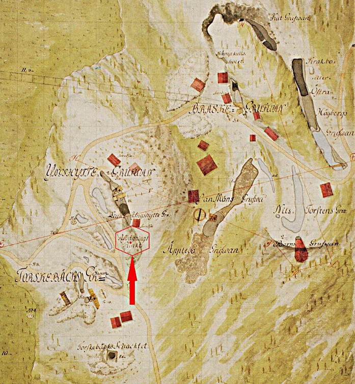
A map from 1784, drawn by A. Polheimer, shows the levelling reference point for the Högberget mines, also known as the zero point.
In a mining area such as the Högberget field, where many mines are located within a limited area, the work of the mine surveyor was of great importance and required high accuracy. In order to produce reliable mine maps, all measurements had to originate from the same reference point – the common levelling point. On mine maps this point is marked ±0.0.
From this point, the elevations of mine shafts, drifts, adits and other important parts of the mining system were determined.
The present zero point consists of a metal bolt driven into the bedrock and is located about 40 metres further to the north, west of the Yngshytte Mine.
Figure 4 shows one of the zero points on Getön.