Laddar...
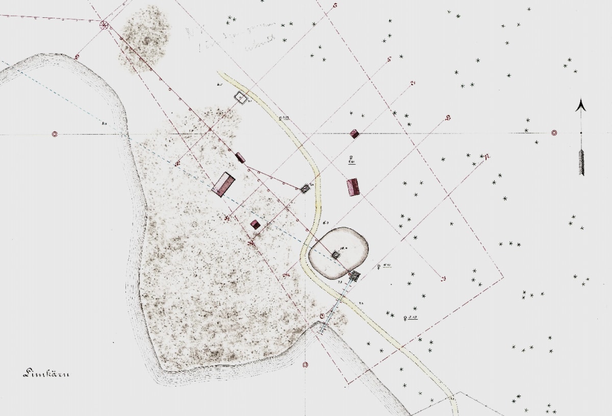
Description of the map of Nya Limkärns Mine in Fernebo Parish, Wermland County
February 6, 1894
Nya Limkärns Mine, worked for magnetic iron ore, is located 3 ½ kilometers west of the Persberg mining field.
At the site, four timbered shafts were sunk, and work began in 1854 using the third shaft in order, counting from the northwest.
Most of the ore has also been extracted here, and mining continued uninterrupted until 1874, after which the mine was water-filled until 1878, when work resumed.
In 1874, the timbered shaft furthest to the southeast was sunk and worked for several years thereafter.
The second shaft in order from the northwest was sunk in 1892. However, the deposit here was poorly concentrated and intersected by numerous granite veins.
In 1893, the shaft located furthest to the northwest was developed, and it is this mine that alone is worked within the concession. The ore here, as in the entire field, is rich and of good quality.
The new map is partly based on an older map drawn in 1860 by A. Sjögren.
Transcription of the original from SGU
T. Nordwall, Dec 2024