Laddar...
The mine likely received the necessary power from the mechanical and hoist turbine located approximately 800 meters to the north on the eastern side of Skribotjärn. (Follow attached link)
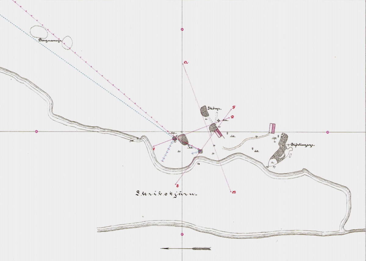
Skribo Mines
”The mines are located on the eastern shore of Skribotjärn, about 4 km from Finnshyttan.
They are first mentioned in the mine master reports in 1761, when 75 barrels of ore were extracted from the Skribotjärn mine.
The mines were later referred to as Skribogrufvan in 1792, 1804, 1805, 1819, and 1820, with 130 barrels of ore extracted in the last year.
Between 1821 and 1823, only very minor work was carried out.
In 1844, Skribogrufvan was reopened from an abandoned claim but was closed after about one year of operation, as the ore was not worth mining.
In 1871 and 1872, the largest mining activity seems to have taken place, with approximately 20,000 ctr of ore and 12,300 ctr of small ore extracted in the last year. The mines are not mentioned in later reports, but it is likely that mining continued for a few more years in the 1870s.
The ore is of very good quality, consisting of bloodstone-mixed black ore enclosed in granite-pyroxene skarn. The bedrock is often loose and friable here, causing the mine walls and ceilings to be unstable, and the water inflow is considerable.
The mines were mapped in 1870 by mine engineer Th. Olsson, whose map partially served as a basis for the current map, but as ore remnants had been removed from walls, pillars, and ceilings since then, most of the mine had to be re-surveyed.
The meridian of the map was determined according to the sun and corresponds to the older map.”
Persberg, Feb. 1900
J.G. Jungner
Transcribed from the original: T. Nordwall 27/12-24